Instructions for using Tree Location Map
The map represents a selection of trees in the park and is being added to on a regular basis. The intent is to eventually have at least one of each type of tree growing in the park, on the map. Where possible trees selected for the map will have a physical label (L) on them. All the paths and trees have been located using GPS on a smartphone, however due to the inaccuracy of GPS if the user is in the park trying to locate a particular tree some degree of patience may be required.
On a PC at home
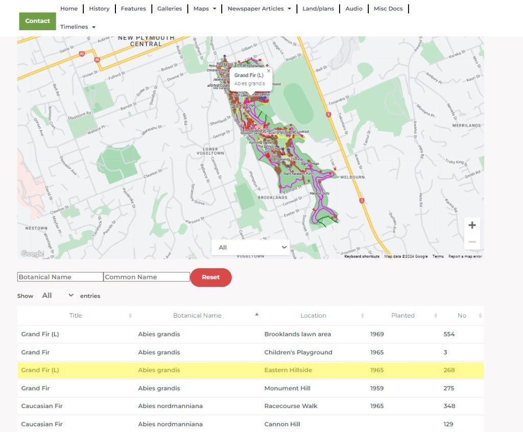
Below the map is a filter function and a table of all the trees on the map.
The table has 5 columns of information:
Title – This is the common name of the trees.
Botanical name – The botanical name of the trees.
Location – this is an approximate location in the park.
Planted – This is the year the tree was planted, if known. Some dates may be approximate.
No – This is a unique number assigned to an individual tree for reference purposes only.
Selecting any of the column titles will result in the column being sorted alphabetically.
Selecting any tree from the list will result in the trees location and information window being highlighted on the map.
The map below has been sorted by Botanical name and tree No 268 was selected to locate.
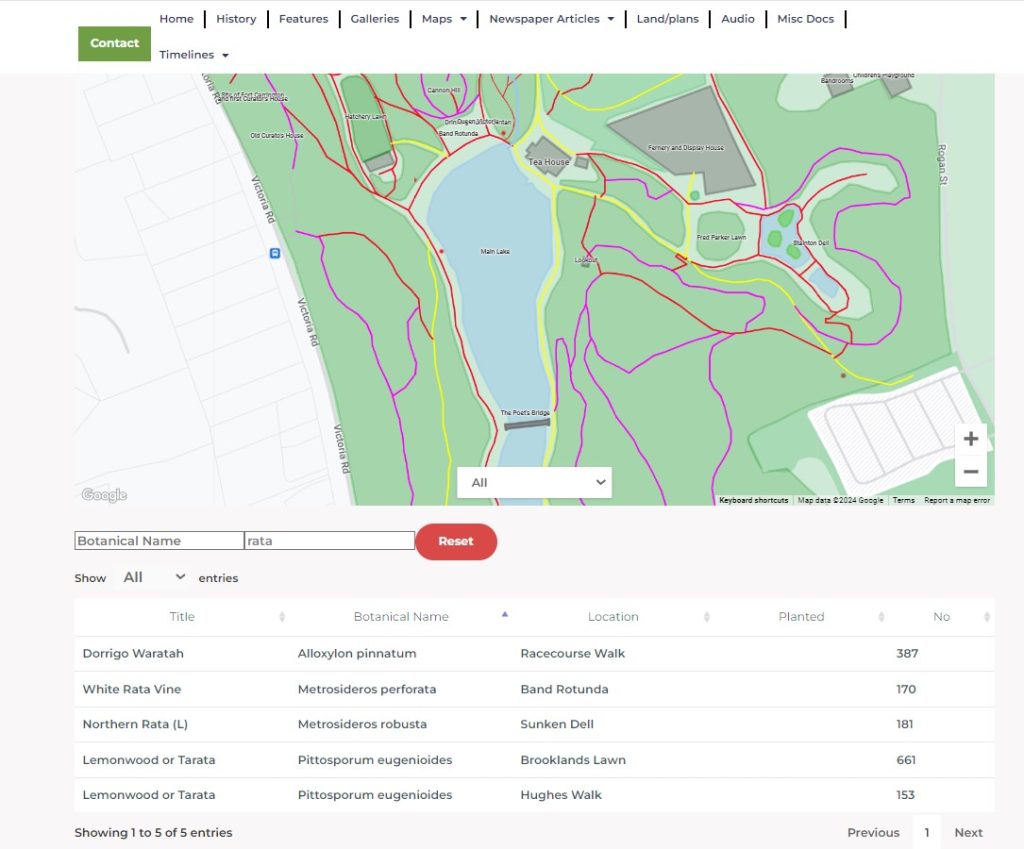
Above the list is a search function, which can search on either by botanical name or common name. This results in the list showing only the trees within that selection.
In the example below, rata was chosen as the common name. Notice that only trees with rata in the name appear on the map. To see the full list of trees once more, hit the reset button.
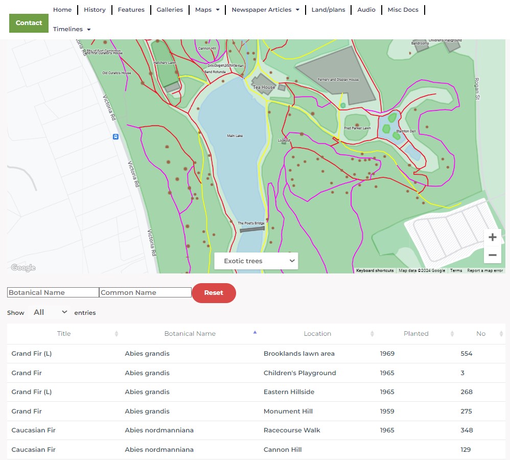
Another form of filtering is by Category. A dropdown at the centre bottom of the map gives the following options: All, Camellias, Exotic trees, Magnolias, NZ Native trees Rhododendron and Palms.
By selecting one of the categories only the trees within that category will show on the map.
In the example below Exotic trees have been selected. Selecting ant one of the trees from the selection will result in that trees location being highlighted.
On a Tablet
The map functions work the same on a Tablet as a pc, however, if the user is in the park, allowing the website to access your location, the user will be able to see their real time location. This will be highlighted by a red teardrop.
Using a Smartphone
Operation of the map using a Smartphone is slightly different because of the limited size of the screen.
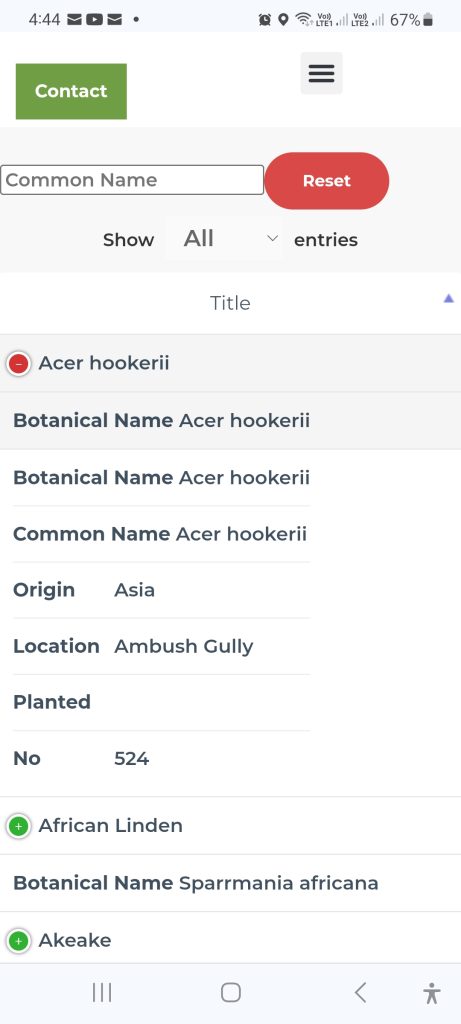
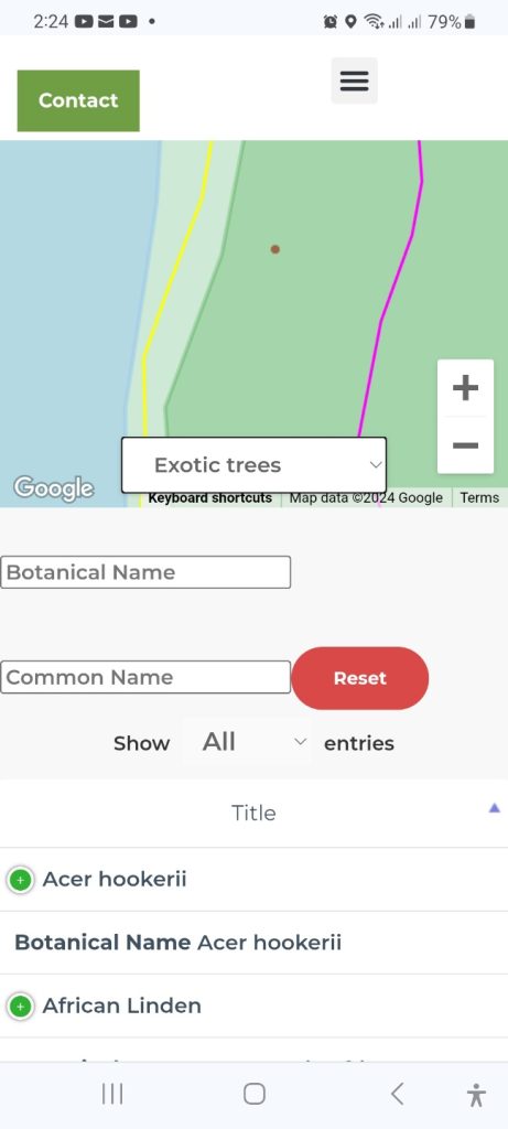
While holding the phone in portrait mode the three search functions: Category, Botanical name and Common Name work the same as on any other device.
The table however operates differently. Only the Title field (Common name) is available for sorting alphabetically. Beneath the common name the Botanical name is visible. By selecting the botanical name the tree selected will be highlighted by the info window appearing on the map.
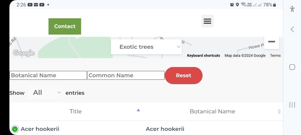
By rotating a phone to landscape mode as shown below the user can sort alphabetically on either the Title field or Botanical name field. By selecting the Botanical Nane that tree will be highlighted on the map.
By selecting the green button in either portrait or landscape mode the other information in the table is revealed.
